Garmin 010C120400 Lakevu G3 Ultra Chart, U.S. East
$199.99
Garmin 010C120400 Lakevu G3 Ultra Chart, U.S. East
Description
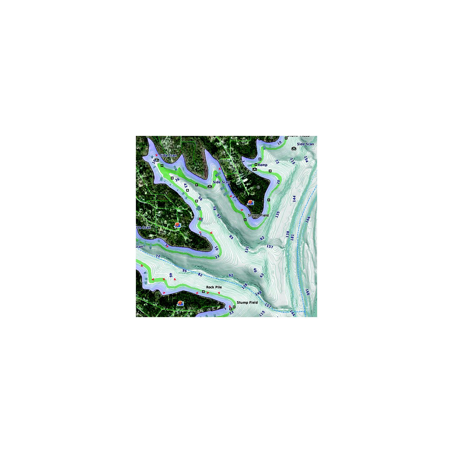
Garmin 010C120400 Lakevu G3 Ultra Chart, U.S. East Experience unparalleled coverage and brilliant detail on the water. LakeV g3 Ultra inland water maps provide industry-leading coverage, clarity and detail with integrated Garmin and Navionics data, Auto Guidance technology and high-resolution relief shading.
Description: LVUS106F – microSD/SD card
Territory: U.S. East
Provides industry-leading coverage, clarity and detail for more than 11,500 lakes with 1 contours that feature integrated Garmin and Navionics data
Auto Guidance technology uses your desired depth and overhead clearance to calculate routes and show a suggested path to follow
High-resolution relief shading combines color and shadow to give you an easy-to-interpret, clearer view of bottom structure than contour lines alone
Covers more than 11,500 HD lakes with up to 1 contours, and more than 100 Garmin Elite survey lakes
Additional information
| Weight | 5 lbs |
|---|---|
| Dimensions | 5 in |
| Description | |
| Territory |
Related products
-

Humminbird 6020071 Lakemaster Premium With VX Technology, Northeast V1
$199.99 Add to cart -
Humminbird 6020031 Lakemaster Premium With VX Technology, Great Plains V1
$199.99 Add to cart -

Humminbird 6010011 Lakemaster With VX Technology, Dakotas & Nebraska V1
$149.99 Add to cart -
Humminbird 6010081 Lakemaster With VX Technology, Southeast States V1
$149.99 Add to cart